


CONNERSVILLE 04, Fayette County, Indiana
About
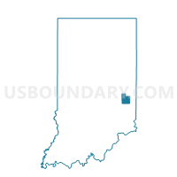
Outline

Summary
| Unique Area Identifier | 577089 |
| Name | CONNERSVILLE 04 |
| County | Fayette County |
| State | Indiana |
| Area (square miles) | 0.16 |
| Land Area (square miles) | 0.16 |
| Water Area (square miles) | 0.00 |
| % of Land Area | 100.00 |
| % of Water Area | 0.00 |
| Latitude of the Internal Point | 39.64348750 |
| Longtitude of the Internal Point | -85.14558590 |
Maps


Graphs
Select a template below for downloading or customizing gragh for CONNERSVILLE 04, Fayette County, Indiana


Neighbors
Neighoring Voting District (by Name) Neighboring Voting District on the Map
- CONNERSVILLE 01, Fayette County, IN
- CONNERSVILLE 02, Fayette County, IN
- CONNERSVILLE 03, Fayette County, IN
- CONNERSVILLE 05, Fayette County, IN